Regional Flood Plan Development
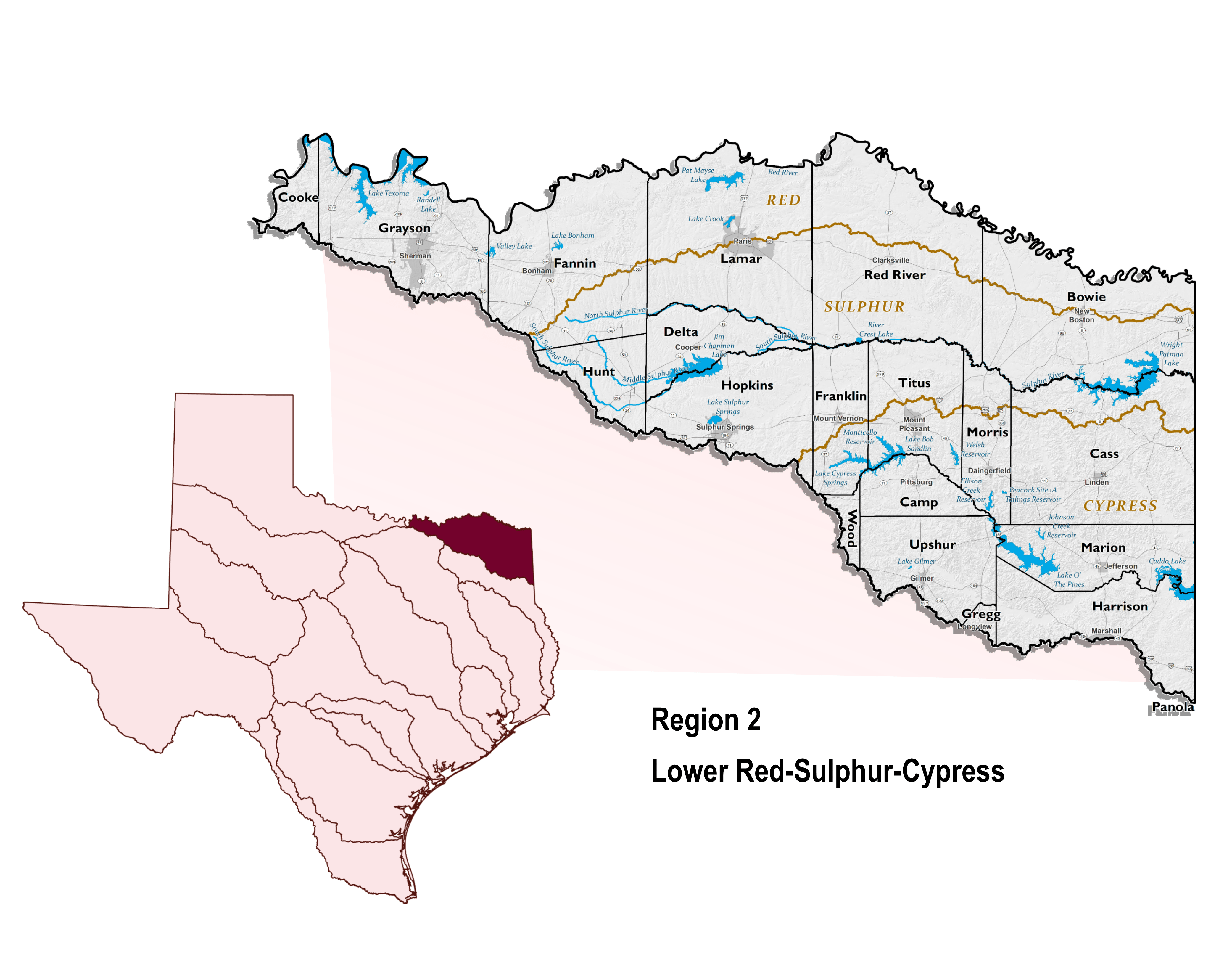
Lower Red Basin
In 2019, the Texas Legislature passed Senate Bill 8 that directed the creation of the first-ever State Flood Plan for Texas. The State Flood Plan brings together the findings of the 15 river-basin-based regional flood plans and makes legislative and floodplain recommendations to guide state, regional, and local flood control policy. The Texas Water Development Board (TWDB) adopted Texas’ inaugural 2024 State Flood Plan on August 15, 2024. The Regional Flood Planning Groups (RFPGs) are now responsible for developing Second Planning Cycle Regional Flood Plans (2028). The overall goal of the RFPGs is to determine the nature of flood risk in the regions, evaluate flood mitigation and management practices, and identify projects that reduce flood risk without negatively affecting neighboring areas.
Who can help? The RFPG is seeking participation from everyone affected by flooding. Using the boxes below, please select which type of stakeholder you represent. If you have any trouble, technical issues or wish to coordinate directly with us, please email us.
When is it due? The RFPG will close data collection in Spring of 2025, to allow sufficient time for compilation and assessment in the development of the regional plan.
Please be advised that all information submitted through this survey and interactive map is subject to public review per Texas Water Development Board requirements.
Seeking additional information?
Information provided is subject to the Texas Public Information Act (Chapter 552 of the Texas Government Code).Community Representative?
Community Stakeholders in the RFPG process include individuals with flood-related responsibilities, such as County and Community officials and Staff as well as Federal, State, regional, and local authorities, utilities and districts.
By registering with your email address and creating a password, you can help provide the RFPGs with localized knowledge of flood planning resources and validate a wide array of flood risk data. Through this data collection effort, the RFPG is requesting community stakeholders:
- Provide information about your contact information and flood-related responsibilities.
- Respond to questions to support the development of the second regional flood plan.
- Verify and provide geospatial data through a provided web map.
The RFPG appreciates any information you are able to verify and provide with the understanding that it may not be possible to provide response to all items.
Member of the Public?
Public Stakeholders in the RFPG process include general public individuals, groups, and organizations including non-profit and non-governmental organizations with an interest in providing information to support flood planning efforts.
By providing your name, address, and email address, you can help provide the RFPG with localized knowledge of flood prone areas and areas where flood mitigation is needed. Your contact information is used to document who is providing information in case we have any follow-up questions.
Once you enter your information, an interactive web map of the region will open. A search feature in the lower right corner of the map enables you to zoom to a particular address. Using the add feature tool, you can leave one or more location pins including a comment or description about flood issues/concerns.